SurfaceScope — RGB-D Depth Profiling for Surface Analysis
An RGB-D depth profiling system for analyzing mineral sample surfaces. Creates 3D reconstructions via pinhole camera model with bilateral filtering, normal estimation, curvature computation, and ISO 4287 roughness metrics.

Business Context
Characterizing mineral sample surface topography traditionally requires expensive contact profilometry equipment. RGB-D depth cameras provide an affordable alternative, but raw depth data is noisy, distorted, and meaningless without a processing pipeline that transforms those pixels into standardized engineering measurements comparable to laboratory instruments.
Strategic Value
The system implements a complete surface analysis pipeline: bilateral filtering preserving edges, pinhole camera model 3D reconstruction, differential geometry computation (surface normals, Gaussian and mean curvature), arbitrary-path profile extraction, and ISO 4287 roughness metrics (Ra, Rq, Rz, Rsk, Rku). Five synthetic scene generators enable validation. Export to PLY/PCD/OBJ formats enables integration with external CAD and analysis tools. Part of the ALGES mineral characterization trio alongside HSI Classification and GrainSight.
The Challenge
Characterizing mineral sample surface topography requires expensive laboratory equipment. Depth cameras provide affordable alternatives but raw depth data needs sophisticated processing for meaningful surface analysis — noise removal, 3D reconstruction, and standardized roughness metrics.
Our Approach
Complete pipeline: synthetic or real RGB-D input, bilateral filtering preprocessing, 3D reconstruction via pinhole camera model, surface analysis (normal estimation, curvature computation), profile extraction along arbitrary paths, and ISO 4287 roughness metrics (Ra, Rq, Rz). Exports to PLY/PCD/OBJ formats.
Key Performance Indicators
| KPI | Baseline | Result | Impact |
|---|---|---|---|
| Surface Analysis | Contact profilometry | Non-contact 3D depth profiling | Accessible surface characterization |
| Roughness Metrics | Manual measurement | ISO 4287 automated (Ra, Rq, Rz) | Standardized surface quality assessment |
Architecture
depth profiler arch

depth profiler pipeline
Non-Contact Surface Analysis
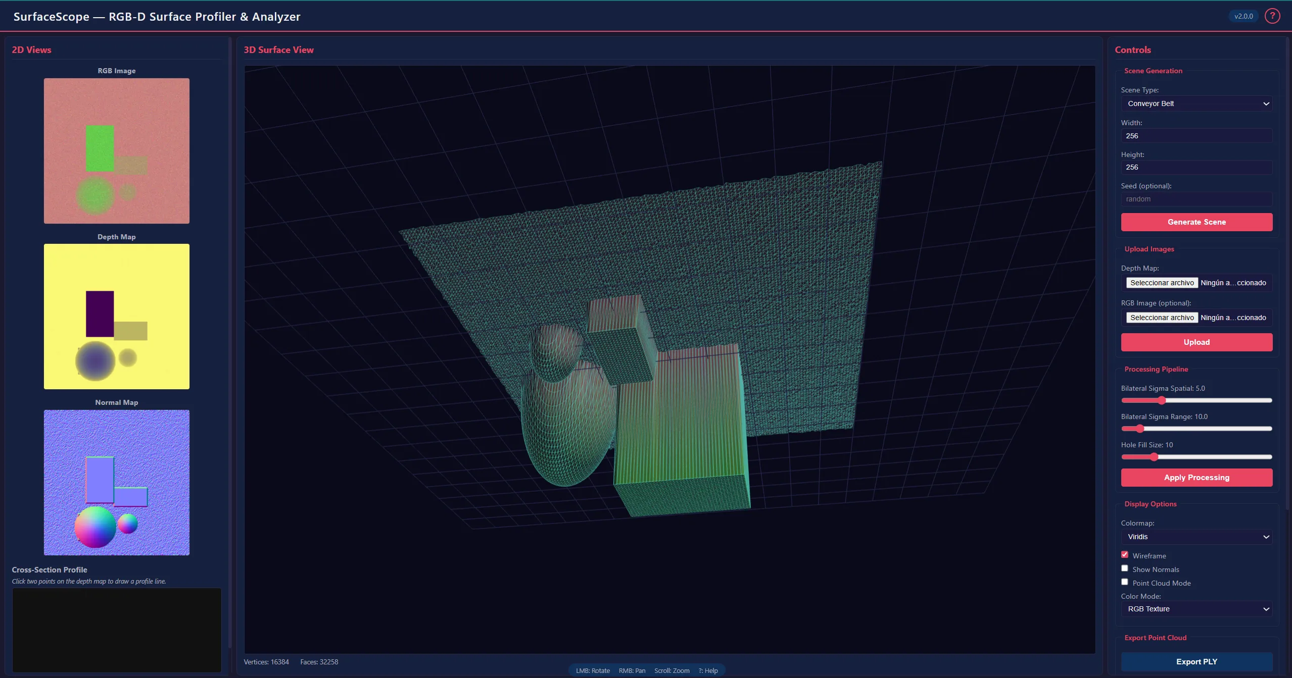
Characterizing mineral sample surfaces traditionally requires expensive contact profilometry — a physical stylus dragged across the sample. RGB-D depth cameras offer an affordable alternative, but raw depth data is noisy, distorted, and meaningless without processing. The value is in the pipeline that transforms those raw pixels into standardized engineering measurements.
The Pipeline
Bilateral filtering is the critical first step. Unlike Gaussian blur, it removes depth noise while preserving edges — essential where sharp transitions between mineral grains must survive the preprocessing, not be smoothed away.
The pinhole camera model transforms depth pixels into 3D point clouds: each (u, v, d) maps to (X, Y, Z) using camera intrinsic parameters. Differential geometry computed on the reconstructed surface reveals features invisible in raw depth: surface normals n = (-∂z/∂x, -∂z/∂y, 1) / ‖...‖, Gaussian curvature K = (f_xx·f_yy - f_xy²) / (1 + f_x² + f_y²)², and mean curvature. Convex grain peaks, concave boundaries, and flat regions become distinguishable.
ISO 4287 roughness metrics provide the engineering output: Ra (arithmetic mean roughness), Rq (RMS roughness), Rz (maximum peak-to-valley), Rsk (skewness), and Rku (kurtosis). Profile extraction along arbitrary paths produces the equivalent of a physical stylus measurement. Full 3D reconstructions export to PLY, PCD, and OBJ formats.
Technology Stack
Application Screenshots